-- Researched and written by SteamCarriage
 |
| Stone, urn, and spike found in the fields of Woodside |
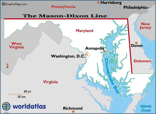
Delaware, Pennsylvania, and Maryland
The first settlers arrived to the lower shores of Delaware in 1631. In 1632 King Charles I granted Cæcilius Calvert, the second Baron of Baltimore, a large estate between the 38th and 40th parallels of north latitude. The land included the present states of Delaware, Maryland, and the lower portion of Pennsylvania. In 1664 King Charles II granted his brother, James Calvert, the Duke of York, all the lands between the Connecticut and De la Ware (Delaware River as it is known today) Rivers which encompassed parts of the present states of eastern Pennsylvania, eastern New York, and most of New England and included the colony at Newcastle (New Castle, Delaware as we know it today).
In 1681 King Charles II granted William Penn all the land north of the 40th parallel up to the 43rd parallel and west of the De la Ware River forcing both the Duke of York and Lord Baltimore to give up some lands previously given them by English monarchs. Penn was required to work out the boundaries. In order to have better access to the ocean, Penn convinced the Duke of York to lease him the land within the 12-mile arc centered on Newcastle along with territory south to Cape Henlopean. In trying to determine where the new boundaries would be located, William Penn, the Duke of York, and Lord Baltimore turned to King James II for resolution.
One issue that turned up involved the Duke of York wanting to insure that Penn wasn’t given rights to York’s settlement at Newcastle. While a 20-mile distance was requested, all parties agreed on a 12-mile arc centered on the Court House in Newcastle. In 1701 Isaac Taylor and Thomas Pierson laid down the first arc marking the boundary between Pennsylvania and Newcastle colony. This agreement marked the birth of the unique arc that forms the present day boundary between Delaware and Pennsylvania.
Lord Baltimore lost his claim on much of the rest of the Delmarva Peninsula lands which were claimed by the Duke of York, when King James II decreed in late 1688 that the lower three peninsula territories (New Castle County was actually the northernmost of three counties referred to at the time as “the lower three counties of Pennsylvania or the lower peninsula territories”) would now become part of the lands owned by Penn. King James II established a loose north-south boundary down the Delmarva Peninsula with Maryland Colony west of the boundary and the “lower three colonies of Pennsylvania” east of the boundary. The boundaries soon fell into dispute between the Penn and Calvert families.
In the early 1730s after a multi-year feud had broken out between the Penn family of Pennsylvania Colony and the Calvert family of Maryland Colony over the location of the east-west border between their two colonies, King George II negotiated a truce. He commissioned surveyor Jeremiah Dixon and astronomer Charles Mason to finally decide, based on colonial records, the boundary line between Pennsylvania and Maryland colonies.
Starting in the mid-1760s it took the Mason and Dixon four plus years (1763-1767) to figure out the 83-mile north-south boundary between Maryland and present day Delaware which at the time was under Penn family rule. The two men would also determine the 233-mile east-west boundary between present day Pennsylvania and Maryland. The boundaries would be marked with limestone blocks, many of which still survive in place today. A few weeks before the signing of the Declaration of Independence the three lower counties of Pennsylvania established themselves as the Delaware Territory, independent of Pennsylvania, Maryland, or Britain. With the signing of the Declaration of Independence the Penn and Calvert families' past feuds no longer mattered.
 |
| The Mason-Dixon Line |
Surveying
the Mason-Dixon Line
In order to perform their work Mason and Dixon
needed to find the point where north-south and east-west boundaries intersected
(northeast corner of Maryland). To do
this they had to resurvey the western part of the 12-mile northern arc boundary
between Pennsylvania’s Chester County and Delaware’s New Castle County. They didn’t resurvey the complete arc
starting at the Delaware River which had they done so would have eliminated
future controversy.
The arc boundary, initially determined when King
Charles II granted William Penn all land north of a 12-mile radius centered at
New Castle, was first surveyed in 1701 by Thomas Pierson of New Castle County
and Isaac Taylor of West Chester County.
The arc was to extend from the Delaware River westward for 120 degrees were
it would terminate. The 12-mile arc boundary
is sometimes referred to as part of the Mason-Dixon Line, however this is
inaccurate and Mason and Dixon did not determine the arc’s total position; only
used its western-most point in determining the east-west Pennsylvania-Maryland
border. Likewise the southern east-west
boundary of Delaware is often referred to as part of the Mason-Dixon Line and
as Mason-Dixon never surveyed this border, only set the southwest intersection
point, Delaware’s southern border is not considered part of the Mason-Dixon
Line.
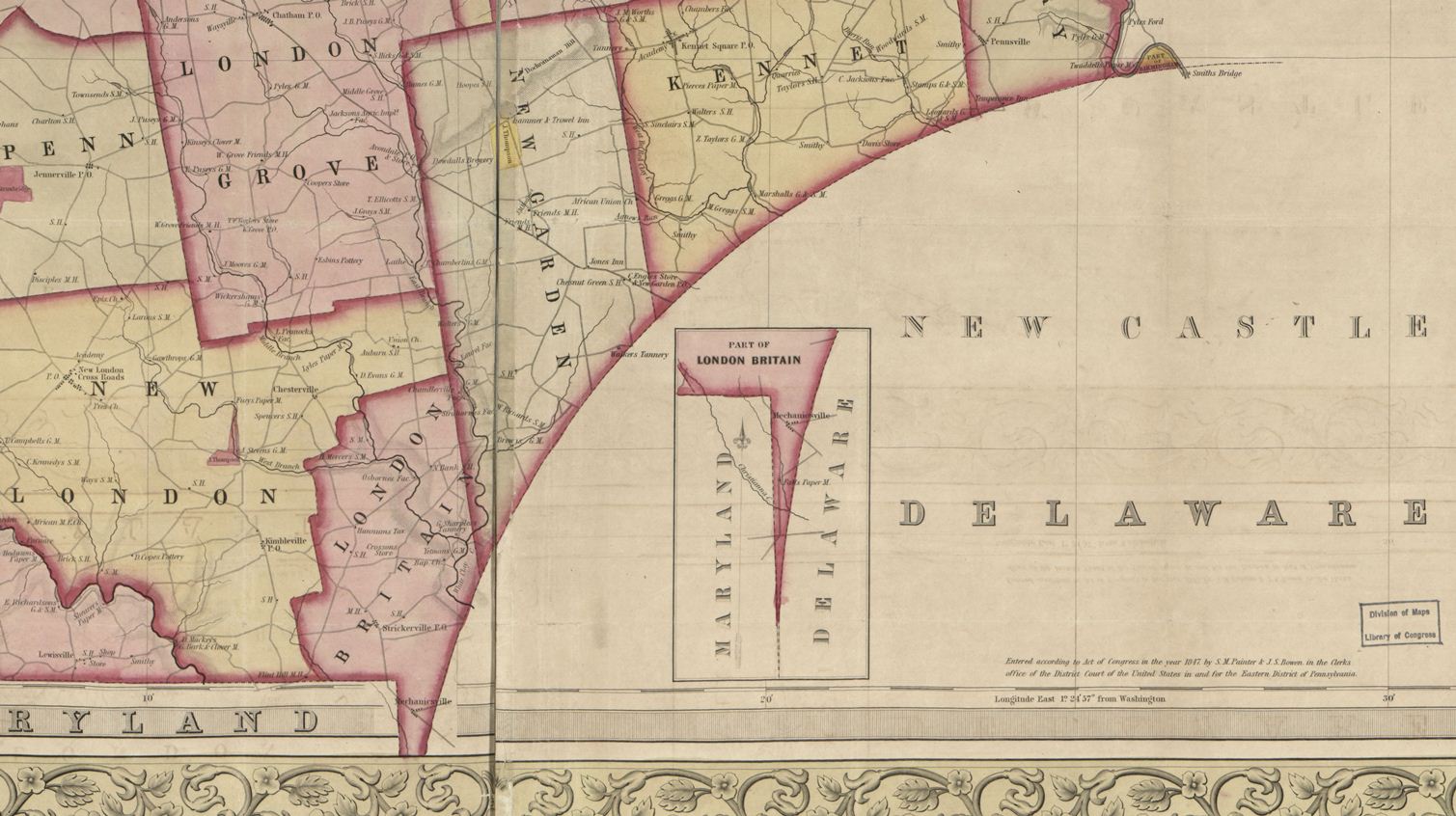 |
| 1847 map showing The Wedge |
Improvements in surveying equipment and techniques brought about more accurate results adding another layer of complexity. Mix in the Mason-Dixon surveys in the 1760s, an additional boundary determination done by Lt. Colonel J.D. Graham in the 1850s, some boundaries being determined from locations with origins as points in the city of Philadelphia, and the only boundaries that weren’t being disputed were the original Mason-Dixon determined boundary between Pennsylvania and Maryland (39 degrees 43 minutes north parallel) and the boundary between Delaware and Maryland from the 12-mile arc southward.
The
“Wedge” and the “Horn”
Depending on how one interpreted various land grants and deeds, the work of Mason & Dixon, and the remaining boundary markers, two pieces of land remained in dispute; the boundary between Chester County Pennsylvania and New Castle County, Delaware. In 1849 a commission was established to resolve the matter once and for all. Unfortunately this effort added more confusion and only made the situation worse. Depending on who’s surveying results you used to define Delaware’s arc and western boundaries, three possible circles defined Delaware’s northern border. The three 12-mile arc boundaries that were questioned as to which was official are shown on the map. Some of the issues determining these three 12-mile arcs were if the steeple or the front steps of the New Castle Courthouse were set at the origin. Is high-tide or low-tide or mean-tide of the Delaware River chosen as the starting point for the 120-degree arc. |
| The Three Different Possible Borders |
What resulted was a long sliver of land that was claimed by both Pennsylvania and Delaware with Pennsylvania claiming the stronger ownership. Pennsylvania even went as far as to show a lower portion of the disputed territory, known as “The Wedge” or “The Flatiron”, on state maps (shown in red on the map below). The territory that made up “The Horn” as it became known (green on the map below) resulted in response to which circle should be used to defined the Pennsylvania-Delaware border.
 |
| The Wedge (in red) and the Horn (in green) |
The dispute involved the exact location of the border point shared by all three states. At its most westerly location all the land in the Horn and Wedge belonged to Delaware and Delaware’s border transitioned from a straight north-south line to the arc in a smooth manner. At its most easterly location, the Horn’s lands would be claimed by Pennsylvania while the Wedge’s lands could be claimed by either Pennsylvania or Delaware. In this scenario the ¾ mile offset in distance between the two locations creates an east-west step transition from the north-south border of Maryland and Delaware to the start of the arc.
An excellent account of the evolution of Delaware's northern boundary, and a pretty clear explanation as to why the 1892 resurvey was needed. In the next post, SteamCarriage will carry us through that survey and explain the stone found in Mr. Mitchell's field.
No comments:
Post a Comment